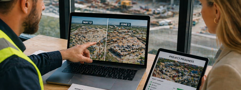
Weekly, Monthly, or Milestone Flights? How to Plan Construction Progress Documentation
Learn when weekly, monthly, or milestone drone flights make sense for construction progress documentation in Greater Houston.
CONSTRUCTION DOCUMENTATION
Ahmed Hamada
9/28/20265 min read


There is no single flight schedule that fits every construction project. A fast-moving site may benefit from weekly aerial documentation, while a longer project with predictable reporting cycles may only need monthly coverage. Other teams get the most value from flights scheduled around major milestones.
The right cadence is the one that matches how quickly visible conditions change and when your team needs a reliable visual record. This guide explains the differences and offers a practical way to choose.
The quick answer
Weekly flights
Best for: Fast sitework, structural progress, active coordination and frequent owner updates.
Main advantage: A close visual timeline of changing site conditions.
Monthly flights
Best for: Routine owner reporting, long-duration projects and slower phases of work.
Main advantage: Consistent documentation without unnecessary flights.
Milestone flights
Best for: Mobilization, grading, foundations, structure, dry-in and closeout.
Main advantage: A record of important visible conditions before the next phase covers or changes them.
Many projects use a combination. A site might begin with weekly flights during rapid earthwork, move to monthly coverage during a slower phase, and add milestone flights before major transitions.
Start with the decisions the imagery needs to support
Before choosing a schedule, decide who will use the files and what they need to understand. Construction progress documentation can help:
Project managers review broad site conditions and completed visible work.
Owners and developers follow progress without attending every site visit.
Remote stakeholders see the same dated visual record.
Teams compare planned viewpoints across capture dates.
Closeout teams retain an organized record of major project stages.
This is different from flying simply because another week has passed. Every visit should have a defined purpose, agreed viewpoints and an expected delivery format.
When weekly flights make sense
Weekly documentation is most useful when visible conditions change quickly or when project teams already work on a weekly reporting cycle.
Examples include:
Clearing, grading and other active sitework.
Foundation and structural phases.
Building-envelope progress.
Large sites where conditions are difficult to understand from ground photographs alone.
Projects with weekly owner or contractor reporting.
A weekly schedule creates a closer sequence of images, making it easier to compare one reporting period with the next. It can also reduce the chance that an important stage passes without being documented.
Weekly flights are not automatically better. If little visible change occurs between visits, the additional files may add cost without adding useful information. The project schedule should determine the flight schedule.
When monthly flights are enough
Monthly flights often work well for long-duration projects, routine executive updates and phases where visible change happens more gradually.
Monthly documentation may be appropriate when:
Stakeholder reports are issued once a month.
The project is progressing steadily but does not need close weekly comparison.
The main purpose is a high-level visual record.
The team wants consistent documentation while controlling the number of site visits and files.
For many owners and developers, a monthly overview provides enough context to follow major changes without creating more imagery than the team will actually review.
When milestone flights provide the most value
Milestone-based flights are scheduled around important project events instead of a fixed calendar. They are especially valuable when visible conditions will soon be covered, removed or substantially changed.
Useful milestones can include:
Before mobilization or major site disturbance.
Completion of clearing or grading.
Foundation completion.
Structural topping out.
Building dry-in.
Major exterior or utility work.
Substantial completion and closeout.
Milestone documentation works well for smaller projects and can supplement a weekly or monthly program. The project team should identify these events during scoping and provide enough notice to coordinate airspace, weather and safe site access.
Consistency matters as much as frequency
Useful progress documentation depends on repeatability. A large collection of attractive images is less valuable when every flight shows the site from unrelated positions.
A planned program should define:
The broad overview angles that will be repeated.
The areas of interest that need closer exterior imagery.
The approximate orientation and framing of each viewpoint.
The file naming and date organization.
The people who need access to the deliverables.
Weather, airspace, active equipment, cranes and safe operating distances can affect exact positioning. Even with those constraints, planned viewpoints make comparisons clearer and keep the deliverables organized around the project.
Choose a cadence with five practical questions
How quickly will visible conditions change? Rapid earthwork or structural activity may justify weekly flights. Slower phases may not.
When are progress decisions and reports made? Schedule capture before recurring owner meetings or reporting deadlines when possible.
Which stages should be preserved in the visual record? Add milestone flights before important conditions change or become concealed.
Who will review the imagery? A project manager may need more frequent detail than an executive stakeholder.
What deliverables are actually needed? High-resolution aerial imagery may be sufficient. A 2D visual map or 3D site model should be separately scoped when broader site context is useful.
Not sure which deliverables your team needs? Compare drone photos, 2D visual maps, and 3D site models.
What a professional documentation package should include
The exact deliverables should be confirmed before the first flight. Depending on the agreed scope, a construction progress package can include:
High-resolution aerial overview and detail images.
Planned repeat viewpoints.
Files organized by project and capture date.
Weekly, monthly or milestone-based delivery.
Optional 2D visual maps or 3D site models for site context.
At Everest Aerial Solutions, every project is planned, flown and reviewed by an FAA Part 107 pilot who is also an API-certified industrial inspector. Files are quality checked before delivery and are typically provided within two to three business days after the flight.
Understand the limits of visual documentation
Aerial construction documentation provides a clear visual record of visible site conditions. It does not by itself certify quantities, confirm schedule compliance, establish legal boundaries or replace survey, engineering, code inspection or other licensed professional services.
Those distinctions should be defined during scoping. If certified measurements, engineering conclusions or survey-grade products are required, the appropriate qualified professional should be involved.
A practical starting schedule
A baseline flight before mobilization or major site changes.
Weekly flights during phases with rapid visible progress.
Monthly flights during slower or more predictable phases.
Additional milestone flights before major transitions.
A final closeout flight using the established viewpoints.
The schedule can then be adjusted as the project moves from one phase to another. The goal is to create the clearest useful record for the people managing and reviewing the project.
Construction progress documentation in Greater Houston
Everest Aerial Solutions provides recurring construction progress documentation for contractors, developers and project teams across Katy and Greater Houston. Capture plans are coordinated around the site, requested viewpoints, active operations, airspace, weather and reporting schedule.
Learn about construction progress documentation or request a project-specific quote.
If your team also needs broader visual site context, see our 2D and 3D visual site mapping service.